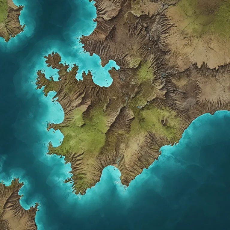
Planning your route with a map of photo locations in central and north Iceland
Creating a thoughtful itinerary begins with a precise map of photo locations in central and north Iceland. When you align your photography goals with the map Iceland and a detailed Iceland map, you can balance driving time, light conditions, and safety. This approach helps you structure each road segment so that every stop, from a quiet waterfall to a busy national park, serves a clear photographic purpose.
Most visitors start or end their trip in Reykjavik, which connects efficiently to the ring road and the golden circle. By plotting the full ring road alongside the diamond circle and the south coast, you can see how central and north Iceland fit into a longer drive that still respects weather and daylight. I highly recommend using interactive tools that show parking lot locations, terrain, and elevation, because they reveal how far each attraction lies from the main road and how much time you should allocate.
For photographers, the best strategy is to cluster nearby attractions on the same day, especially when chasing northern lights or soft evening water reflections. A curated map of photo locations in central and north Iceland lets you group waterfalls, hot springs, and lava fields into coherent themes that match your preferred style of photography. This structure also supports responsible travel, because you can plan rest stops, fuel, and food in advance rather than improvising in fragile landscapes.
Key landscapes and attractions along the central highlands and north coast
Central Iceland offers stark lava fields, remote hot springs, and wide open landscapes that feel almost lunar. When you overlay these areas on a map of photo locations in central and north Iceland, you see how the interior tracks connect back to the ring road and the more populated coast. Because conditions can be harsh, it is essential to check each road status and confirm whether a 4x4 is required before committing to a long drive.
North Iceland contrasts with the south coast by offering quieter black sand beaches, dramatic sea cliffs, and a different angle on the northern lights. Around the diamond circle, you will find some of the best viewpoints for water shaped canyons, geothermal hot springs, and ice capped peaks that frame your Iceland photo compositions. Integrating these stops with culinary or cultural experiences, such as those described in this guide to local cuisine and culinary heritage in polar regions, enriches long days on the road.
Many photographers pair the golden circle and the snaefellsnes peninsula with at least several days in east Iceland and the north coast. This combination lets you capture famous attractions while still leaving time for quieter nature reserve areas and lesser known waterfalls. With a well prepared Iceland map, you can ensure that every segment of your trip includes varied water features, glacier views, and coastal scenes that keep your photography fresh.
Waterfalls, glaciers, and water shaped canyons for dramatic photography
Water is the defining element in many of the best Iceland photo locations, especially in central and north Iceland. When you study a map of photo locations in central and north Iceland, waterfalls appear like a chain of visual anchors along the ring road and the diamond circle. Each waterfall has its own character, from narrow chasms to wide curtains, and the surrounding lava fields or black sand can transform a simple scene into something cinematic.
Glacier fed rivers carve deep canyons that reward patient photography, particularly when low angled light reveals textures in the rock and ice. In winter, the same water sources contribute to frozen formations and reflective surfaces that work beautifully with northern lights arcs. During summer, longer daylight hours give you more time to experiment with shutter speeds, capturing both silky water and crisp detail in a single trip.
Some of the most famous attractions combine water, ice, and volcanic rock in one frame, which is why they appear repeatedly on any serious Iceland map for photographers. I highly recommend scouting each location in advance using satellite views, so you understand where the parking lot sits relative to the main viewpoints and any safety barriers. This preparation allows you to move efficiently on site, respect local guidelines, and still leave space for creative compositions that go beyond the standard postcard angle.
Chasing northern lights and night skies in north Iceland
North Iceland is particularly appealing for northern lights photography because of its darker skies and lower population density. When you consult a map of photo locations in central and north Iceland, look for areas away from major towns yet still close to a safe road and a marked parking lot. This balance between remoteness and accessibility is crucial, especially when ice or sudden storms affect driving conditions at night.
Combining the diamond circle with segments of the ring road gives you multiple foreground options for aurora, including coastlines, waterfalls, and snow covered lava fields. Many photographers also integrate the snaefellsnes peninsula or east Iceland into their itinerary, creating a flexible ring that increases the chances of clear skies somewhere along the route. Because weather can change quickly, it is wise to keep your Iceland map and forecast apps open side by side, adjusting your drive in real time.
“Summer offers long daylight hours and lush landscapes, while winter provides opportunities to capture the Northern Lights and snow-covered scenes.” This guidance reflects how seasonality shapes both your map highlights and your expectations for night photography. In practice, that means planning extra time for scouting during daylight, noting safe pullouts, and identifying compositions that will work well once the sky darkens and the aurora begins to move.
Practical logistics for photographers on Iceland’s roads
Thoughtful logistics turn a beautiful Iceland map into a realistic, safe itinerary for photography. Before setting out with your map of photo locations in central and north Iceland, review road conditions, daylight hours, and fuel availability along each segment. Check weather conditions before traveling, as they can change rapidly, and remember that even the best attractions are not worth a risky drive on ice covered roads.
Accessibility varies; some sites are easily reachable by car, while others may require hiking or specialized vehicles. It is important to research each location beforehand, especially if it lies within a national park or a protected nature reserve with specific rules. Respect local guidelines and restrictions, especially in protected areas, and ensure you have necessary permits for drone usage where applicable.
For longer journeys that combine the ring road, the golden circle, and the south coast with central and north Iceland, consider alternating intense photography days with slower cultural or wildlife experiences. Resources such as this article on locally guided wilderness experiences illustrate how guided days can complement self drive exploration. This rhythm helps you maintain concentration behind the camera while still appreciating the broader context of Iceland’s communities and fragile environments.
Ethical and environmental considerations for Iceland photography
Responsible photography in Iceland begins with understanding that every road, trail, and parking lot exists within a delicate ecosystem. Iceland’s diverse landscapes offer unparalleled opportunities for landscape photography, but they are also vulnerable to erosion, trampling, and off road driving. When using any Iceland map or map highlights, stay strictly on marked routes and respect closures, even if that means adjusting your planned compositions.
Local authorities and rangers work to balance access with conservation, particularly in national park areas and nature reserve zones. Tour operators and photography communities increasingly emphasize low impact practices, such as avoiding mossy lava fields and keeping drones away from wildlife or busy viewpoints. Yes, drone usage is regulated, especially near airports, national parks, and populated areas ; always check local regulations before flying.
For photographers, the best mindset is to treat every Iceland photo as a privilege that carries responsibility toward future visitors. Increased interest in capturing the northern lights and dramatic water scenes should translate into stronger support for conservation, not more pressure on fragile sites. By aligning your map of photo locations in central and north Iceland with ethical choices on the ground, you help ensure that Iceland’s glaciers, coasts, and hot springs remain inspiring subjects for many years.
Key statistics and essential FAQs for planning your Iceland photography trip
Selected statistics for planning
- Number of photo spots in North Iceland : 92 locations.
- Total photo spots in Iceland : 1189 locations.
Frequently asked questions
What are the best times of year to photograph in Iceland ?
Summer offers long daylight hours and lush landscapes, which is ideal for covering extensive sections of the ring road, the golden circle, and the south coast with your Iceland map in hand. Winter provides opportunities to capture the northern lights, snow covered lava fields, and ice framed waterfalls that dominate many map highlights in north Iceland. Your choice of season should match your tolerance for cold, your interest in night photography, and the amount of time you can dedicate to driving between attractions.
Are there any restrictions on drone photography in Iceland ?
Yes, drone usage is regulated, especially near airports, national parks, and populated areas, and these zones are often clearly marked on an updated map of photo locations in central and north Iceland. Always check local regulations before flying, and verify whether a specific nature reserve or hot spring area has additional rules beyond national guidelines. Respecting these restrictions protects wildlife, reduces noise for other visitors, and helps maintain access for responsible photographers.
How accessible are these photography locations ?
Accessibility varies ; some sites are easily reachable by car from Reykjavik or the ring road, while others may require hiking or specialized vehicles on interior tracks. It is important to research each location beforehand, using both an Iceland map and recent trip reports to understand terrain, parking lot conditions, and seasonal closures. By planning carefully, you can safely reach a wide range of waterfalls, coasts, and glacier viewpoints without overextending your daily driving time.
