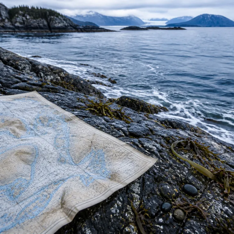
Reading a map of Prince William Sound before you sail
A detailed map of Prince William Sound is the single most useful planning tool for any refined Alaska coastal journey. When you spread out a large chart of this intricate sound, the fjords, islands, and glacier-carved inlets immediately explain why navigation here demands respect. That same map of Prince William Sound also reveals how close the coast of Alaska lies to deep ocean basins, shaping weather, wildlife, and the entire travel experience.
Cartographer Tom Patterson created a shaded relief map of this North American fjord system that many expedition leaders now use as a visual briefing aid. His work builds on decades of U.S. Geological Survey (USGS) and National Oceanic and Atmospheric Administration (NOAA) charts, which together show how the coastal marine landscape has shifted as glaciers retreat. When you compare older USGS and NOAA charts with Patterson’s more recent map, the changing outline of the south-central Alaska coast becomes a quiet but powerful lesson in climate and time.
Travelers often ask where to find a reliable map Prince William Sound overview that still respects technical detail. Official NOAA nautical chart series for Prince William Sound remain the gold standard for mariners, while USGS shaded relief maps excel for understanding the broader coastal area. For a first trip, I recommend printing a large-format map of Prince William Sound and pairing it with digital chart updates on your navigation device, so you always see both the big picture and the fine-grained channels.
From Valdez to the Copper River: orienting your Arctic gateway
Most travelers meet Prince William Sound through Valdez, the compact Alaska port town tucked beneath steep mountains. On any good map of Prince William Sound, Valdez appears as a sheltered corner at the eastern end of the sound, where coastal marine waters meet road access to the interior. That junction between ocean and road makes Valdez a practical subarctic gateway for ski touring, glacier cruises, and small ship expeditions that feel distinctly Arctic in character.
Trace your finger east on the map and you reach the Copper River delta, where braided channels spill into the sound copper colored with glacial silt. This is where rivers, lakes, and tidal flats create a vast wetland that attracts migratory birds and supports subsistence fishing communities. When you study several charts side by side, the scale of the Copper River system becomes clear, and you understand why shipping traffic must respect both ecological sensitivity and complex currents.
North of Valdez, steep valleys marked on the map hint at backcountry ski potential, though avalanche risk and rapidly changing weather demand expert guidance. Families considering winter-themed trips sometimes combine a Valdez stay with more accessible festive experiences such as an Arctic-style Christmas escape in Washington State, described in this North Pole at the fair feature. Whether you come for marine wildlife, coastal scenery, or human history, a carefully studied map of Prince William Sound turns what could be a simple cruise into a layered exploration of Alaska’s maritime frontier.
Understanding charts, shipping routes, and mariners’ tools
For anyone planning to sail, kayak, or join a small expedition vessel, the difference between a decorative map and a working nautical chart matters. A nautical chart of Prince William Sound shows depths, hazards, aids to navigation, and recommended shipping lanes that a simple tourist map cannot provide. Mariners rely on NOAA nautical chart series for these waters Alaska wide, because they integrate hydrographic surveys, tide data, and regular chart updates.
In Prince William Sound, commercial shipping routes weave between islands and along the coast, sharing space with cruise ships, fishing boats, and tour operators. Responsible captains study both paper charts and electronic mariners chart systems, cross-checking positions and watching for changes in the coastal marine environment such as new shoals or altered buoy positions. This layered approach reflects a core safety principle in Alaska’s complex sound systems, where weather and visibility can deteriorate in minutes.
Recreational travelers do not need the same level of technical detail, yet understanding the basics of a nautical chart makes every voyage more engaging. Before boarding, spend time with a large-scale map of Prince William Sound and ask the crew to point out your route, key headlands, and any national forest shorelines you will pass. If you enjoy cartography, you may also appreciate how city mapping elsewhere in Alaska supports gateway travel, as shown in this guide to using a city map of Ketchikan as an Arctic gateway tool.
From science center walls to framed prints at home
Maps of Prince William Sound are not only navigation tools; they are also striking visual records of a coastal landscape in motion. Many Alaska science center exhibits mount large wall charts of the sound, allowing visitors to trace glacier tongues, fjords, and island chains while staff explain ongoing research. In these settings, the map becomes a bridge between marine science and public understanding, especially when paired with photographs and satellite imagery.
Because so much of the cartographic base is in the public domain, artists and printers have turned the region’s geography into décor. You will find Tom Patterson’s shaded relief map reproduced as a framed print, a canvas poster, or even a minimalist line chart suitable for a study or library. Some galleries in Valdez and along the coast Alaska corridor offer shipping-framed options, so travelers can send a carefully packaged map home without carrying it through the rest of their Arctic itinerary.
When choosing a decorative map, look for clear labeling of key features such as Prince William Sound, the Copper River delta, and adjacent national forest boundaries. A good framed map of Prince William Sound should still function as a legible reference, not just wall art, so you can revisit your journey years later. If you prefer a more technical aesthetic, consider a reproduction of an older NOAA nautical chart, which preserves the look of traditional mariners chart design while still reflecting the essence of these waters.
Climate change, sea ice, and evolving coastal maps
Every modern map of Prince William Sound carries a quiet footnote: the coastline and glaciers it depicts are changing rapidly. USGS glacier inventories indicate that more than one hundred and fifty glaciers feed into or near the sound, and many have retreated significantly over recent decades. As ice pulls back, new coves, islands, and shallow waters emerge, forcing cartographers and mariners to rely on frequent chart updates and revised USGS topographic mapping.
Visitors sometimes assume that a printed chart is timeless, yet in a dynamic coastal marine system that assumption can be risky. NOAA and partner agencies now integrate satellite imagery and aerial photography to refine both topographic maps and NOAA nautical chart products for Alaska, including Prince William Sound. This is why official guidance stresses that travelers should consult updated maps before traveling, be aware of changing glacier positions, and use maps for general reference only.
The story of shifting ice in Prince William Sound connects directly to wider polar change, including the fragile state of Antarctic sea ice. For a deeper look at how scientists now assess long-term sea ice loss, many travelers read analyses such as this report on why Antarctic sea ice may never fully recover, hosted on our polar science insights hub. Whether you are planning a coastal cruise, a ski-supported expedition, or a photography voyage, treat every map as a snapshot in time and ask your operator how they integrate the latest data into route planning.
Practical tips for using a map of Prince William Sound on your trip
Once you have chosen a reliable map of Prince William Sound, the next step is learning how to use it effectively during travel. Start by marking your embarkation port, likely Valdez or Whittier, then trace your planned route through the sound’s main channels. This simple exercise helps you visualize distances, understand where the open ocean lies beyond the outer islands, and see how protected the inner coast can be on windy days.
On board, keep a folded chart or small canvas-covered map handy in the lounge or your cabin. Each time the captain announces a headland, glacier, or wildlife sighting, locate it on the map and note how the surrounding area is shaped by mountains, rivers, and fjords. Over several days, you will build an intuitive sense of the sound’s geography that no digital screen alone can provide.
Travelers with a deeper interest in navigation can ask the bridge team, when permitted, to explain how they combine electronic mariners chart systems with paper NOAA nautical chart backups. Many officers are happy to point out how shipping lanes avoid sensitive national forest shorelines, how soundings guide safe passage in shallow waters Alaska wide, and how chart updates reflect new data from hydrographic surveys. By the end of a well-guided voyage, the once abstract map of Prince William Sound becomes a lived memory, each inlet and island tied to a specific moment at sea.
Key figures behind the mapping of Prince William Sound
- The mapped area of Prince William Sound covers roughly 25,000 square kilometres, according to U.S. Geological Survey coastal mapping summaries, making it one of the most intricate coastal regions in Alaska.
- More than 150 glaciers feed into or near Prince William Sound, a density that explains the abundance of fjords and the heavy glacial silt carried by the Copper River into the sound.
- U.S. Geological Survey geologists W.H. Condon and J.T. Cass produced early geological maps of the Prince William Sound area, which later cartographers used as a foundation for refined coastal charts.
- Tom Patterson’s shaded relief map of Prince William Sound, released through USGS and other public domain channels, integrates updated satellite imagery to show modern glacier positions and topography.
- NOAA’s ongoing chart updates for Prince William Sound support safer navigation for both commercial shipping and expedition travel, reflecting the region’s rapidly changing coastal marine environment.
FAQ about maps of Prince William Sound for Arctic travelers
Where can I find a detailed map of Prince William Sound ?
Detailed maps are available through USGS and Wikimedia Commons. For navigation, rely on official NOAA nautical chart series, which cover Prince William Sound and adjacent waters Alaska wide. Many expedition operators also provide printed overview maps during pre-departure briefings.
What are the main features shown on maps of Prince William Sound ?
Most maps highlight topography, glaciers, fjords, and major islands, giving a clear sense of how the sound is carved into the Alaska coast. Geological maps add information on rock types and faults, while nautical charts focus on depths, hazards, and aids to navigation. Together, these products help travelers understand both the scenic and structural character of the region.
How have Prince William Sound maps changed over time ?
Early mid twentieth century maps emphasized geology and basic coastal outlines, while modern charts incorporate precise satellite and sonar data. As glaciers have retreated, cartographers have had to redraw shorelines, add new islands, and adjust depth soundings. The result is that recent maps show a more intricate, and often less icy, coastline than older editions.
Do I need a nautical chart if I am joining a guided cruise ?
Passengers are not required to bring their own nautical chart, because licensed vessels must carry up-to-date official charts and electronic navigation systems. However, having a personal map of Prince William Sound greatly enriches the experience, allowing you to follow the route and understand the geography. A simple tourist map is usually sufficient for this purpose, though enthusiasts may enjoy studying full NOAA charts.
Are printed maps still reliable in such a fast changing environment ?
Printed maps remain reliable for general orientation, but they cannot capture every short-term change in glacier fronts or shallow areas. This is why guidance for the region stresses that travelers should consult updated maps before traveling, be aware of changing glacier positions, and use maps for general reference only. For precise navigation, mariners combine paper charts with digital systems that receive more frequent updates.
