Why firn air content in Antarctica matters for travellers
When you sail towards Antarctica, you are not just heading for ice and penguins. You are entering a continent where the hidden structure of firn and the air trapped within it quietly controls how safe the ice surface remains for landings and overland journeys. Guides planning routes across the white horizon must understand how this transitional snowpack, the intermediate state between snow and solid ice, stores air and water beneath your boots.
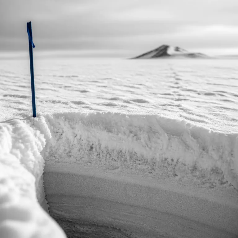
Firn is snow that has persisted for at least one year without melting, transitioning between snow and glacial ice. This layered formation gradually undergoes densification, squeezing out pore air and turning accumulation snow into harder accumulation ice that can support vehicles and people. Where surface melt increases, that densification accelerates, changing the total volume of air-filled pores and altering how the ice layer responds to weight and to sudden meltwater pulses.
Researchers now track firn air content in Antarctica using the IMAU Firn Densification Model (IMAU FDM; Ligtenberg et al., 2011, https://doi.org/10.5194/tc-5-809-2011), a sophisticated numerical tool that simulates how each layer evolves. For expedition planners, these IMAU FDM outputs help identify accessible zones where the snowpack remains stable and where low accumulation or intense melt might have created hidden ice slabs. In practice, this means modelled firn air data are combined with satellite images and field reports to decide which landing sites remain accessible and which must be avoided during a season of strong surface melt.
From soft snow to ice slabs: how firn changes under your feet
Every time you step ashore from a Zodiac, you cross a complex stack of firn layers that have survived many seasons of wind, accumulation, and melt. Over time, repeated surface melt events can refreeze within the snowpack, forming an ice layer or even a thick ice slab that blocks the downward percolation of water. These ice slabs and thinner ice layers reduce the accessible pore space, a process scientists call firn air content depletion or simply FAC depletion.
When FAC depletion progresses, the total air volume in a region drops, and the firn can no longer absorb meltwater like a sponge. That trapped water instead runs off the surface as meltwater runoff, carving channels that destabilise nearby ice shelves and sometimes making shore approaches less accessible for travellers. Warming reduces firn air storage capacity, leading to increased meltwater runoff and potential ice shelf collapse.
On some parts of the Antarctic Peninsula, slab formation has already transformed once soft firn into hard, impermeable ice slabs that extend for kilometres. Field studies have documented slabs several metres thick, with pore spaces almost completely sealed, so meltwater is forced to spread laterally rather than soak downwards (e.g. Kuipers Munneke et al., 2014, https://doi.org/10.1038/nclimate2220). For travellers, the presence of an ice slab or multiple ice slabs means firn air is reduced, crevasse patterns can shift, and guides must adapt routes to avoid zones where runoff concentrates and refreezes into treacherous slabs.
Key scientists behind firn air research that shapes your voyage
Several leading researchers have turned firn air content in Antarctica into a practical tool for understanding travel risk and ice shelf stability. Sanne B. M. Veldhuijsen, a glaciologist at Utrecht University, focuses on how low accumulation and increasing surface melt change firn air and FAC depletion across key regions. Her work on the Roi Baudouin Ice Shelf, for example, shows how accumulation ice and firn layers interact with meltwater to influence where ice slabs form (Veldhuijsen et al., 2023, https://doi.org/10.1038/s43247-023-00911-0).
Michiel R. van den Broeke, frequently referenced as van den Broeke, leads an équipe at Utrecht University that developed the IMAU FDM, the firn densification model now widely used in Antarctic studies. Within this IMAU FDM framework, Willem Jan van de Berg, often shortened to van de Berg, refines the climate forcing, while Peter Kuipers Munneke, known as Kuipers Munneke, links firn changes to ice shelf processes and visible surface melt patterns. As Kuipers Munneke has put it in interviews, “once the sponge is gone, the ice shelf becomes much more vulnerable from above.” Together, these experts use the model to simulate how total FAC evolves, how accessible pore space remains for meltwater storage, and where ice shelves may become vulnerable.
For families planning an Antarctic voyage with teenagers, this science might seem distant, yet it quietly informs which itineraries remain viable and safe. When you read a premium family guide to choosing ships, cabins, and shore landings in Antarctica, the recommended landing sites often sit on firn zones where accumulation remains healthy and FAC depletion is still low. Behind the scenes, the same researchers, including Sanne Veldhuijsen and Kuipers Munneke, provide the data that operators use to judge whether an ice shelf or ice shelf edge can safely host visitors in a changing climate.
Where travellers meet firn air content: Antarctic Peninsula and Roi Baudouin
Most expedition ships focus on the Antarctic Peninsula, where dramatic peaks rise straight from the sea and ice shelves fringe the coast. In this region, firn air content in Antarctica has already declined, especially in zones of low accumulation where repeated surface melt events have produced extensive ice slabs. A recent synthesis suggests that parts of the Peninsula have lost on the order of 20–40% of their original firn air capacity since the late twentieth century (Veldhuijsen et al., 2023; Medley et al., 2022, https://doi.org/10.1038/s43017-022-00345-6). Travellers may not see the trapped air itself, yet they experience its loss through more frequent melt ponds, altered snow texture, and occasional closures of once accessible landing sites.
On the Roi Baudouin Ice Shelf, a less visited but scientifically crucial area, researchers have mapped how accumulation ice, firn layers, and ice slabs interact. Here, low accumulation years can accelerate FAC depletion, while intense surface melt seasons create a patchwork of ice layers and slabs that change how runoff flows towards the ocean. These patterns influence whether the ice shelf remains stable enough for long term travel operations or whether operators must retreat to more stable coastal ice shelves.
When you choose an itinerary, ask how your operator evaluates firn conditions on the Antarctic Peninsula and beyond. Responsible companies now consult IMAU FDM outputs and related climate model data to understand where total FAC remains high enough to buffer meltwater and where accessible pore space has shrunk. This approach helps them keep shore excursions accessible while avoiding fragile ice shelf edges where firn air loss and slab formation have increased the risk of sudden calving or surface collapse.
How climate models and firn data guide safe Antarctic travel
Behind every safe landing on Antarctic ice lies a chain of models, measurements, and expert judgement. The IMAU FDM, often combined with regional climate models such as RACMO2.3p2 (van Wessem et al., 2018, https://doi.org/10.5194/tc-12-1479-2018) and global simulations like CESM2 (Danabasoglu et al., 2020, https://doi.org/10.1029/2019MS001916), allows scientists to estimate firn air content in Antarctica across vast, inaccessible regions. These tools simulate how accumulation, densification, and melt interact to change each firn layer, predicting where ice slabs and impermeable ice layers will form.
For travel planners, the key outputs include maps of total FAC, zones of low accumulation, and areas where surface melt and runoff are projected to intensify. When total FAC drops and FAC depletion accelerates, the accessible storage that can safely hold meltwater shrinks, raising the likelihood of surface ponds and sudden drainage events. Operators use these projections, together with satellite imagery and on-site inspections, to decide whether a particular ice shelf, such as parts of the Antarctic Peninsula or Roi Baudouin, remains suitable for seasonal landings or should be treated as a no go zone.
Travellers benefit when operators integrate this science into practical decisions about route timing and shore logistics. A voyage scheduled earlier in the season may encounter firn with higher accessible FAC and fewer ice slabs, while a later departure might face more extensive slab formation and more pronounced runoff channels. Asking how your chosen company uses firn models, including the IMAU FDM and related climate tools, is a direct way to gauge their commitment to safety and environmental responsibility.
Practical tips for travellers: reading the ice and choosing operators
As a guest, you do not need to run a firn densification model, but you can still read subtle signs on the ice. When you step onto shore, notice whether your boots sink into soft firn or rest on a hard, glazed ice layer that may signal underlying ice slabs. On one late-season landing near the Antarctic Peninsula, for instance, a guide halted a hike after noticing water-filled cracks refreezing into a thin, brittle crust—an on-the-ground sign that the local firn “sponge” was close to saturated. Guides trained in Antarctic fieldcraft will point out melt ponds, runoff channels, and refrozen slab formation features that reveal how firn air content in Antarctica is changing in real time.
Choosing an operator that respects these signals is essential for both safety and sustainability. Look for companies that reference current research by experts such as Sanne Veldhuijsen, van den Broeke, van de Berg, and Kuipers Munneke, and that mention using IMAU FDM or similar tools to assess total FAC and FAC depletion. Operators who discuss low accumulation trends, surface melt patterns, and the condition of nearby ice shelves are usually more transparent about the risks and more willing to cancel a landing when accessible FAC has declined too far.
Responsible travel also means understanding how regulations adapt as polar science advances. For example, changes to wildlife approach rules in Svalbard, explained in this guide to how new polar bear regulations reshape Arctic cruises, mirror the way firn and ice shelf research increasingly shapes Antarctic landing policies. By supporting operators who integrate firn air data, accumulation trends, and slab formation insights into their planning, you help ensure that the ice beneath future travellers remains both accessible and resilient.
Key statistics on firn air content and Antarctic travel
- Recent syntheses in journals such as Nature Reviews Earth & Environment highlight a measurable decline in firn air content in parts of Antarctica, with some coastal sectors of the Antarctic Peninsula losing roughly one third of their original pore volume since the 1990s, reducing the capacity of firn layers to absorb meltwater and increasing the risk of surface runoff near popular travel regions (Medley et al., 2022).
- On several Antarctic Peninsula ice shelves, repeated surface melt seasons have produced extensive ice slabs and impermeable ice layers, which can extend for several kilometres and reach thicknesses of 1–5 m, significantly altering where safe landing zones can be established for expedition visitors (Kuipers Munneke et al., 2014).
- Studies using the IMAU FDM firn densification model show that areas with low accumulation and strong warming experience the fastest FAC depletion, meaning that even modest increases in melt can rapidly transform once porous firn into dense accumulation ice with limited accessible FAC (Ligtenberg et al., 2011; Veldhuijsen et al., 2023).
- Research campaigns on the Roi Baudouin Ice Shelf have documented how changing firn structure, including slab formation and evolving ice layers, influences meltwater routing, with implications for both ice shelf stability and the long term viability of nearby coastal travel operations (Veldhuijsen et al., 2023).
FAQ about firn air content and Antarctic travel
What is firn and why does it matter for Antarctic visitors ?
Firn is the intermediate state between fresh snow and solid glacial ice, formed when snow survives at least one year and begins to compact. Its porous structure stores firn air and meltwater, so changes in firn air content in Antarctica directly affect how stable landing sites remain and how safely guides can route passengers across the surface.
How does warming affect firn air content and ice shelves ?
Warming increases surface melt, which can refreeze into ice layers and ice slabs that block percolation, causing FAC depletion and reducing total FAC. As a result, more meltwater runs off across the surface, which can undermine ice shelves from above and contribute to ice shelf collapse near some coastal travel regions.
Which regions show the biggest changes in firn air content ?
The Antarctic Peninsula and parts of coastal East Antarctica, including the Roi Baudouin Ice Shelf, show some of the most pronounced changes. These areas combine relatively low accumulation with rising temperatures, leading to more frequent surface melt, more slab formation, and a faster decline in accessible FAC.
How do scientists study firn air content in remote areas ?
Researchers such as Sanne Veldhuijsen, van den Broeke, van de Berg, and Kuipers Munneke use a combination of field measurements, satellite data, and firn densification models like the IMAU FDM. These tools simulate how each firn layer evolves, allowing them to estimate total FAC, FAC depletion, and the formation of ice slabs even in regions that are rarely visited.
What should travellers ask operators about ice and firn conditions ?
Travellers should ask whether the operator consults up to date firn and climate model data when planning landings, especially on or near ice shelves. Questions about low accumulation trends, surface melt observations, and how guides assess ice layers and slabs on site can reveal how seriously a company treats both safety and environmental stewardship.
References for further expert reading
- Medley, B. et al. (2022). "Antarctic firn and its role in ice-sheet mass balance." Nature Reviews Earth & Environment, 3, 754–771. https://doi.org/10.1038/s43017-022-00345-6
- Ligtenberg, S. R. M., Helsen, M. M., & van den Broeke, M. R. (2011). "An improved semi-empirical model for the densification of Antarctic firn." The Cryosphere, 5, 809–819. https://doi.org/10.5194/tc-5-809-2011
- Veldhuijsen, S. B. M. et al. (2023). "Firn air depletion and surface melt on the Roi Baudouin Ice Shelf, East Antarctica." Communications Earth & Environment, 4, 163. https://doi.org/10.1038/s43247-023-00911-0
- Kuipers Munneke, P. et al. (2014). "Firn air depletion as a precursor of Antarctic ice-shelf collapse." Nature Climate Change, 4, 943–948. https://doi.org/10.1038/nclimate2220
- van Wessem, J. M. et al. (2018). "Modelling the climate and surface mass balance of polar ice sheets using RACMO2 – Part 2: Antarctica." The Cryosphere, 12, 1479–1498. https://doi.org/10.5194/tc-12-1479-2018
- Danabasoglu, G. et al. (2020). "The Community Earth System Model Version 2 (CESM2)." Journal of Advances in Modeling Earth Systems, 12, e2019MS001916. https://doi.org/10.1029/2019MS001916
